1.800.336.5437
Low Price GuaranteeTrack OrderWish ListEZ ReturnsMonday through Friday 7am to 7pm Saturday 8am to 4pm
- MOUNTAIN TIME
- ¡Hablamos español!


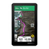
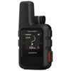
Garmin Zumo XT2 Motorcycle Navigator
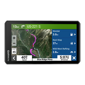
Garmin Zumo XT2 Motorcycle Navigator
Part# 2118370001People who have viewed this item have also viewedSee all GPS/Navigation
Additional Videos
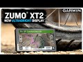
Garmin® zumo® XT2 | LARGE and ULTRABRIGHT display

Garmin Support | zumo® XT2 | Getting Started

Garmin Support | zumo® XT2 | Using Tread® App Features
Garmin® zumo® XT2 | LARGE and ULTRABRIGHT display
Details
The rugged Zümo XT2 motorcycle navigator is built for adventure. Its 6" display is glove-friendly, rain-resistant and shows you the adventurous way — on and off the beaten path. Get adventurous routes with turn-by-turn directions for on-road navigation, or switch to topographic maps or BirdsEye Satellite Imagery for off-road guidance.- Large, 6-inch screen
- Tread app compatible.
- Ultrabright, day and night (~1000 nits)
- Crisp HD resolution
- Choose portrait or landscape view
- Cap touch, like a tablet (with strengthened glass)
- Glove-friendly
- Rain-resistant (IPX7)
- Sleek, aerodynamic design
- Does not rely on cell signal
- Pictures and descriptions of notable parks, monuments, museums and historic sites
- Find the best established, wild and dispersed campsites
- Easily find visitor centers, picnic areas, campgrounds, and trailheads
- TripAdvisor® traveler ratings for restaurants, hotels and attractions
- Use with inReach satellite communicator for interactive SOS, two-way messaging and location sharing
Street Maps (North America): - Turn-by-turn, spoken street directions – can be heard through *connected helmet or headset
- Map updates included
Preloaded Topography (North & Central America): - Off-road, "point to point" map guidance
- Trail data
- Public land boundaries, 4x4 roads, forest service roads, waterways, unimproved roads, trails and other land use data
BirdsEye Satellite Imagery (Coverage Around the World): - Direct-to-device downloads
- No annual subscription
- Download your route while connected to Wi-Fi then access it later, even when offline
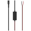
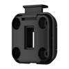
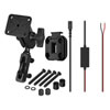
- Includes Zumo XT2 Unit, Motorcycle Mount & Hardware, Motorcycle Power Cable, USB Cable, and Documentation.
Garmin Zumo XT2 Motorcycle Navigator Reviews
 Each review submitted enters you into a
$100 gift card monthly drawing and a
$500 gift card quarterly drawing!
Each question or answer submitted enters you into a:$100 gift card monthly drawing and a
$500 gift card quarterly drawing!